GERS Demonstrations
Within the Overture ecosystem, member companies and collaborators have created several GERS prototypes and demonstrations to help you get started with data matching and GERS ID assignment.
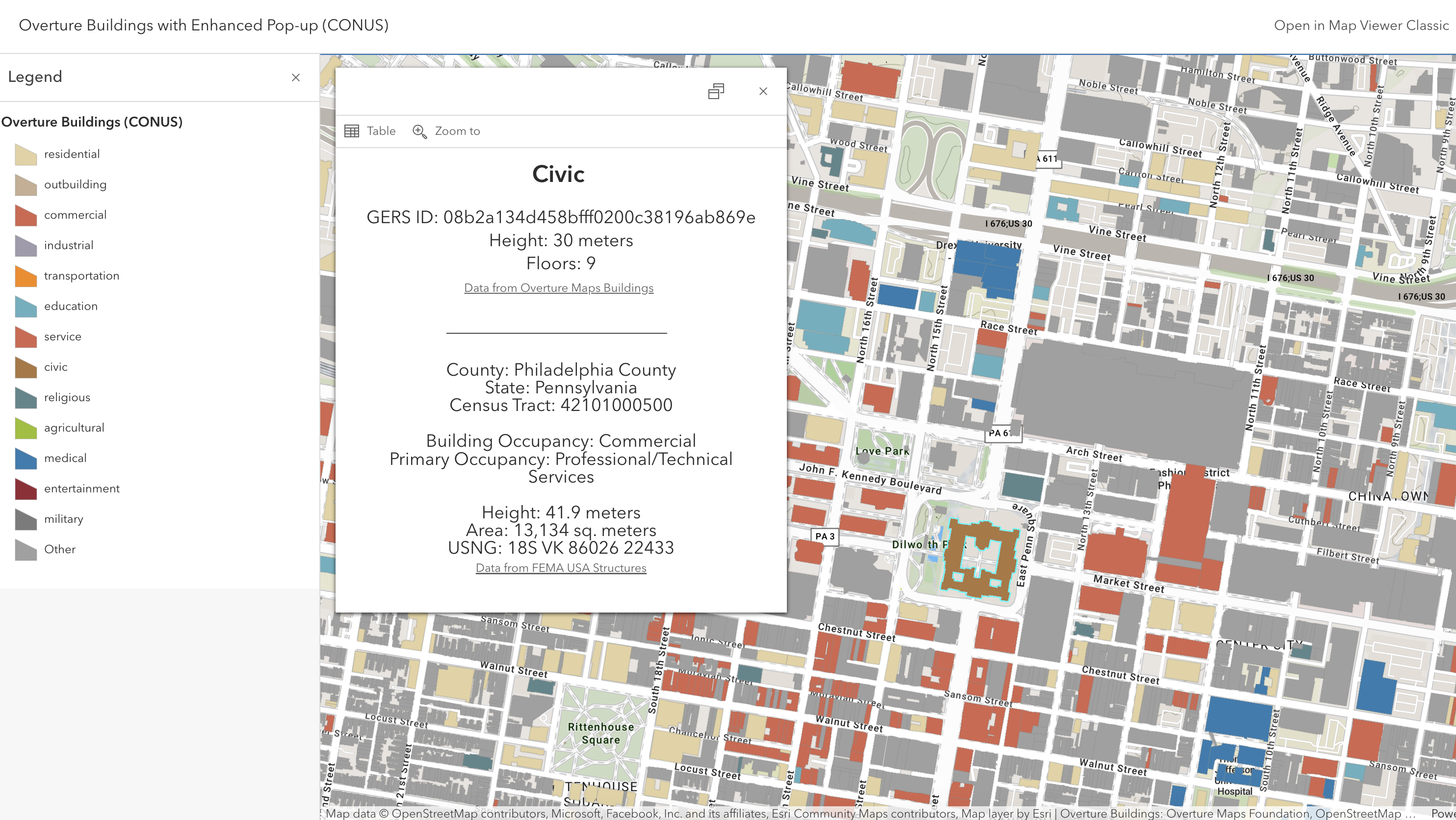
Esri
Esri, a general member of the Overture Maps Foundation (OMF), has taken the lead in creating and sharing examples of GERS-enriched data. In their initial GERS demonstration project following Overture's October 2023 release, Esri matched Overture buildings with FEMA's USA structures in four cities and created an enhanced pop-up window showing the combined properties from both datasets for each feature, including the GERS ID and FEMA USA Structures UUID. More recently, Esri created a map showing Overture buildings data enriched with the FEMA data for the Contiguous United States (CONUS).
Esri has also shared a feature layer combined data from the Overture divisions theme, Census county geometries, and Census socioeconomic data (GERS ID to FIPS).
TomTom
TomTom, an OMF steering committee member, shared a blog post about the importance of GERS in Overture's transportation data model: https://engineering.tomtom.com/overture-transportation-network-linear-referencing/
Safegraph
Safegraph, a contributing member company of OMF, wrote a blog post and tutorial about Placekey facilitating matches between Overture POIs and National Provider Identifier (NPI) data. The notebook associated with the tutorial is available here: https://colab.research.google.com/drive/17BimmoiW4bqpyBb0-MdK2z9MwcSVAb-8?usp=sharing
Precisely
Drew Breunig of Precisely, a contributing member of OMF, put togther a step-by-step guide to joining Overture buildings data to Census Block Group data using DuckDB: https://www.dbreunig.com/2024/06/25/using-duckdb-spatial-joins-to-map-overture-gers-ids-to-us-census-fips-codes.html